
May 2015 Water Level Chart
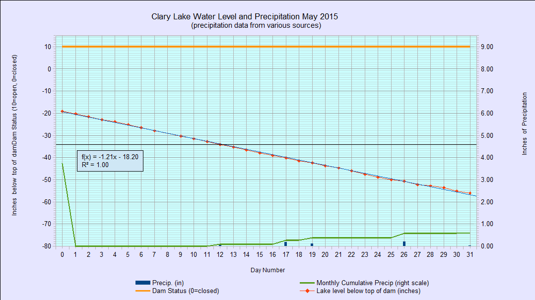
Behold the May 2015 water level chart. After rising to within 12″ of the top of the dam on 23 April, the lake has fallen steadily to about where it was before the spring melt started back on March 24th. At that time the lake level was at -57.12″ below the top of the dam. At -56.04″ we’re within an inch of that now.
For the month of May, the lake level dropped 35.76″ in 31 days, or about 1.15″ per day, a rate that was negatively affected by the lack of rain. Normally we get about 3.7″ of rain in May which would have offset the fall in the lake level considerably, however this year we received only 0.60″ of rain for the entire month. As a result, as a quick look at the chart will show, the lake level fell every day. Also, because it was so dry, evaporation contributed significantly to the daily water level drop. Since the high on April 23rd, the lake level has fallen 43.32″ in 39 days or 1.11″ per day. Normally you would expect the rate of fall to slow gradually as the level dropped. Below 48″ the usual rate of fall is about 1/2″ per day.
We can all take comfort in knowing that this ongoing ecological disaster won’t be ongoing forever. It will be a little while longer, but normal water levels WILL BE RESTORED.