January 2018
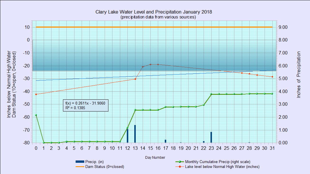
I have archived the January 2018 Water Level Chart (at left) starting us off on another year of sub-par water levels. The most notable feature of the January chart is that the lake level actually made it up into the “allowable” range (for this time of year), reaching a high of -19.08″ below the normal high water mark on January 15th as the result of nearly 2.5″ of heavy rains and snow melt. Gotta love January thaw! I had stopped making measurements on December 31st but the warm weather and rapidly rising lake level made getting down to the lake and actually finding the water surface relatively easy.
Precipitation for the month of January was 3.81″ most of which we received in a big storm in the middle of the month. Average for January is only 2.6″ so already we’re 1.2″ above normal for the year, but the year is just starting.
All told I only made 8 water level measurements for the month of January and I don’t expect to resume measurements on anything like a regular basis until sometime spring. I’ll try and grab a few measurements between now and then if the opportunity presents itself.