January 2017
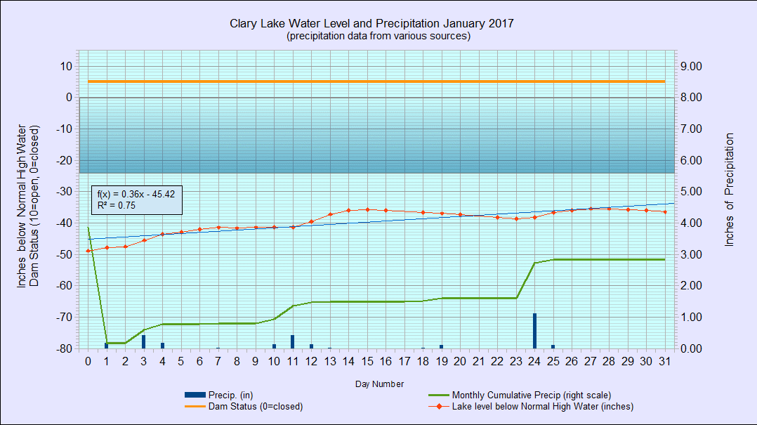
I have archived the January 2017 Water Level Chart (at left). The most notable feature of the January chart is nothing, really. Kind of a ho-hum chart if you ask me. The lake level was at -48″ below the normal high water mark (HWM) at the start of the month and ended the month at -36.5″ or about a foot higher. The lake level was severely low for the whole summer and fall so seeing the lake rise marginally higher has been comforting. That said, the gate on the dam has been open about half way for the entire month, considerably more than the opening called for in the Water Level Order. Anyway you want look at it, the dam owner is still in clear violation of the Clary Lake water level order.
We received 2.84″ of precipitation during the month, some in the form of snow and some as rain. Average precipitation for January is 2.6″ so we’re starting the month a little ahead for a change. We started this year in Severe drought (drought intensity D2) but we’re now in Moderate drought (drought intensity D1) however with the ground frozen, very little water is going to get into the water table until spring.
In a little over 3 months, without excessive rainfall, the lake has come up 31″ since reaching it’s low back on October 20th.