January 2016
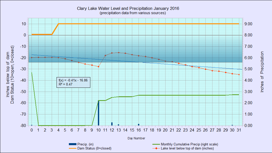
I’ve archived the January 2016 Water Level Chart (at left). The most notable thing about it is that the gate was closed for the first 3 days of the month, and that the lake got up to 15″ below the top of the dam on January 13th. It has fallen steadily at about 1″ per day since then however, and ended the month about 35″ below the top of the dam. For a little more than 1/2 the month the lake level was at or higher than 2 feet below the top of the dam. It hasn’t been that high for that long since sometime in 2010. We received 2.7″ of precipitation for the month, most of it in the form of rain. Average precipitation for January is 2.6″ so we’re just wee bit ahead so far this year though still showing a precipitation deficit from last year.
We had a couple of days of decent ice skating around the 8th of January but then it snowed and rained. The falling water level combined with warming temperatures led to some pretty strange ice conditions later in the month.
You’ll also notice that the black line on the charts at 34″ that marked the approximate bottom of the hole in the dam has been removed. I got rid of it because I no longer believe that figure is accurate.