
February 2017
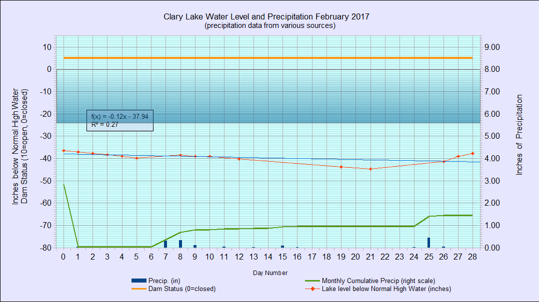
I have archived the February 2017 Water Level Chart (at left). The most notable feature of the February chart is how relatively stable the lake level was for the month, considering we received 1.44″ of precipitation, well below the average precipitation for February of 2.44″ (for Augusta). The lake level started the month at -37″ below the Normal High Water Mark (NHWM) and dropped to a low of -44.6″ on February 21st before ending the month 1/2″ higher than it started, at -36.5″ below the NHWM. The dam’s gate remained half open for the entire month, though the dam owner felt compelled to open it all the way on the first day of March, an action consistent with his observed behavior of trying to keep the lake level below the hole in the dam which is somewhere around -34″ below the top of the dam. There was no water flowing through the hole when I drove by the dam yesterday.
Now if the dam stayed closed till spring I’d be a happy camper…and lakeshore owner!