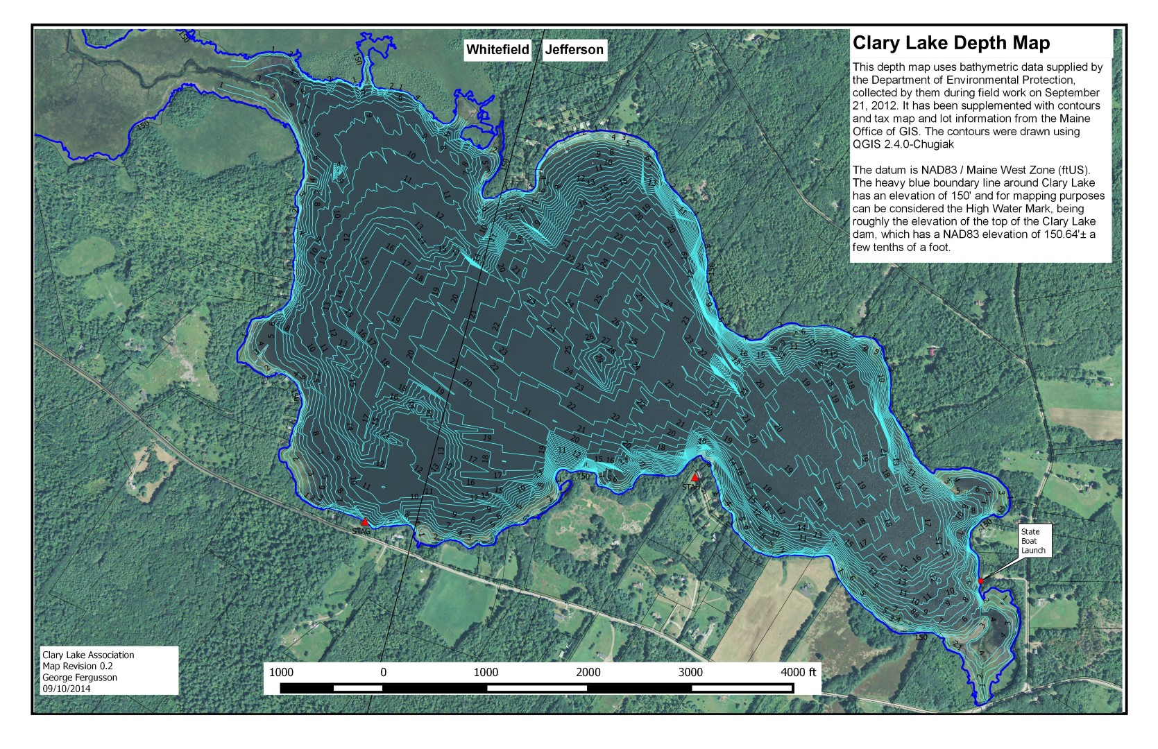
 I’ve updated the recently released bathymetric chart with new contours using some additional data in the vicinity of the ledges at the northwest end of the lake and a few other rocks. The revised contour map now clearly shows both those ledges and the rock currently marked by a white buoy in the vicinity of the Whitefield/Jefferson town line near the north shore. Also, the 148′ and 146′ contours have been replaced with 1′ depth contours making this version of the chart more accurate in depicting the shallow water around the shoreline. I will, as time permits, further refine the underlying data.
If you’re not seeing version 0.2 dated 09/10/2014 (check lower left hand corner) try clearing your browser’s image cache.
Several people asked about getting a contour map superimposed on an aerial photograph. No problem! There are now two images available, a large scale one and a smaller more manageable image (click on the thumbnail at upper left). They’re also available on the Maps, Charts, and Graphs page. You’ll also find a .KMZ file there which you can load into Google Earth.