
July 2017
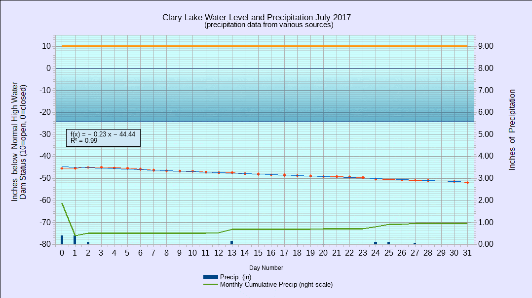
I have archived the July 2017 Water Level Chart (at left). The most notable feature of the July chart is how slowly the lake level fell especially considering how little rainfall we received over the month. We saw this same phenomena in June but it was even more pronounced in July. In July the lake level fell an average of only 0.21″ per day, falling a total of only 6.48″ over 31 days which is even more remarkable considering we only received 0.95″ of rain in July. For comparison, in June we the lake level fell only 0.38″ per day for a total of 11.4″ drop for the month during which we received only 1.88″ of rain. Average rainfall for July is 3.43″ so for the month we were 2.48″ low and for the year we’re 3.9″ shy of the average.
Back in June I was hard put to explain why the lake level was dropping so slowly, but the reason has finally become clear: the outlet channel is so full of plant growth that it’s impeding the outflow of water from the lake. Go figure. Continuing plant growth also explains why the outflow rate has continued to slow in July and will likely slow even further in August. Outflow at the dam is just a trickle now, and fully half of the daily drop in lake level is due to evaporation.