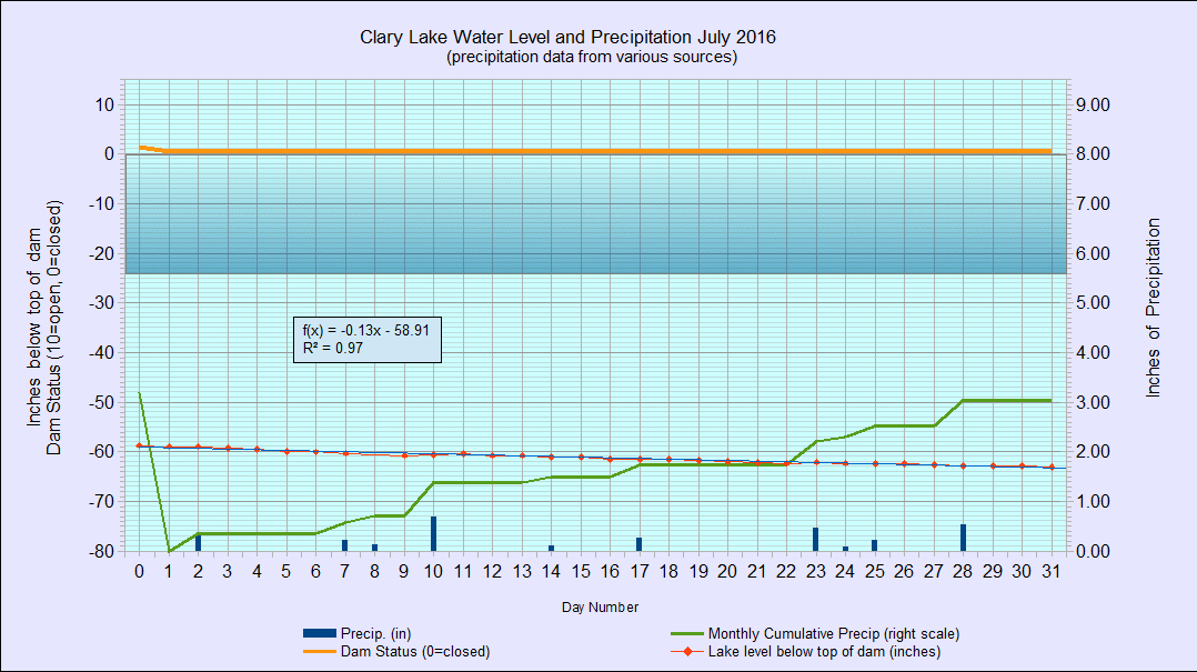
July 2016
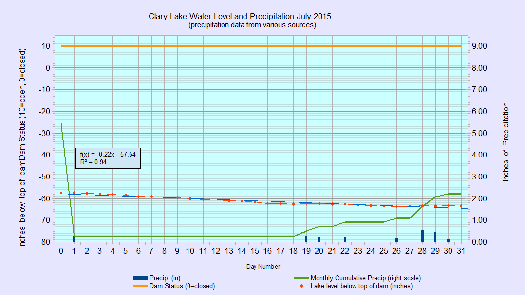
I’ve archived the July 2016 Water Level Chart (at left). The most notable feature of the July chart is that despite the dam’s gate being effectively closed for the whole month, the water level still fell slowly but steadily for pretty much the whole month, starting out at -58.92″ below the top of the dam and ending at -63.00″ for a total loss of 4.08″ most of which was due to evaporation: the small amount of water that can be seen flowing through the gate in the dam is just ground water seeping out of the marsh; there has been no flow of water out of Clary Lake for most of the month. If you’re thinking this is sounding familiar, it is because it is: July 2016 is almost a day-for-day repeat of July 2015.
We received a total of 3.05″ of rain during the month, about 1/2″ less than normal. The only benefit I can see of the lack of rain and the resulting lack of runoff this year is that it has helped maintain lake transparency.