 I hope everyone has been enjoying the hot weather we’ve been getting. I for one am grateful for living close enough to the lake that I can just throw myself in the water to cool off whenever I feel like it, and I’ve been feeling like it quite a bit. It’s hard for me to imagine how people can survive in the city in this kind of heat. We’re fortunate to have received so much rain lately, some of those afternoon thunderstorms have been some real splashers. While they haven’t done much to cool the air off, it’s been enough to largely offset the falling lake level. In the first 6 days of this month we’ve received almost 1″ of rain.
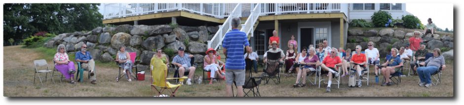
Tomorrow afternoon I’m heading up to the Branch Pond Association annual meeting to talk to them about the water level petition process. Their public hearing is scheduled for August 23rd. On the off-chance anyone wants to go with me, I’ll be leaving about 1 PM. Give me a call.
When I haven’t been floating in my tube this past week I’ve been sitting at my computer working on my Findings of Fact and Conclusions of Law, the deadline for submission of which is 5 PM this coming Monday afternoon. I’m in good shape and expect to get them submitted sometime around mid-day so I can take the rest of the afternoon off and float in my tube. I’ll post them here and send around a Petition Update after I’ve submitted them.
When I haven’t been floating in my tube or working on my findings, I’ve been learning about KML (Keyhole Markup Language). KML is similar to XML which is not much at all like HTML, which I’m pretty familiar with. In other words, when it comes to KML, I haven’t got a clue, but I’m learning. KML is the markup language that you use to put your data onto Google Earth and into Google Maps. This is all part of the watershed survey initiative. To that end I’ve built a new Clary Lake Watershed Survey Base Map which incorporates the Jefferson and Whitefield tax maps. Here’s a link to the new survey base map:
Clary Lake Watershed Survey Base Map V.2
After you’ve played a bit with the map that is embedded in the web page, click on the “View Larger Map” link at the bottom left corner of the map which and see what you can do with a full-blown Google Map. Check out “Street View” (drag that little man on the zoom slider over to a road and see what happens). Pretty neat stuff.
Had a nice visit with the folks from Branch Pond Association. Most of the meeting was spent talking about the upcoming Branch Pond water level petition public hearing- who is going to testify, what they’re going to say, etc. There are a LOT of similarities between Branch Pond and Clary Lake it turns out. Beautiful little pond.