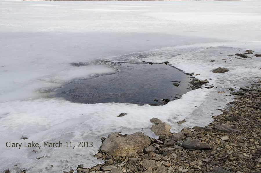
 This is a large spring hole out in front of my property. with the lake level as low as it is, there is more opportunity to observe springs in the lake. I also have observed 4 or 5 more along the immediate shore. It has prompted me to wonder how many more there are around the lake. So, how about looking out in front of your property and report on any that you see. It will help in George’s and my efforts to understand more fully the dynamics of lake level variations. David
Clary Lake Association
Preserving and Protecting Clary Lake
Thanks for posting that David. I’ve become convinced that a lot of the “missing water” in our lake level fluctuation calculations can be accounted for by inflow from springs.
I’ve got 3 fairly productive springs right adjacent to my shoreline, one of which has been open since mid-January. It has made making water level measurements easier than it was shoveling snow and chopping a hole in the ice. Here are links to pictures of the spring holes:
https://clarylake.org/Winter%202013/target14.html
https://clarylake.org/Winter%202013/target15.html
https://clarylake.org/Winter%202013/target16.html
The second one is the same spring hole I photographed last December when the ice was forming:
It too has been open since mid-January.
Some of you will remember me writing last fall about outflow rates and orifice diameters and such and complaining that for all the water flowing out through the open gate, the lake wasn’t falling fast enough by a factor of almost 2. You can review that discussion in the 2012 News page for November and December.
After the last snow storm I spotted open water over on the other side of the lake, by the end of the Duncan road. Doug Kinney confirms there has been a strip of open water there for a while that keeps getting bigger. Springs might contribute to this phenomena but I think it is more but it is more likely an effect of the flow of water towards the outlet speeding up a little and becoming more turbulent when it passes over the shallows off the point. This is due to the so-called “venturi effect”, a phenomena usually associated with automobile carburetors and pipes but it also applies to the laminar flow of water around obstructions in streams, rivers, and ponds. Duncan point both extends out into the lake a ways and the water is quite shallow off the point- both are in effect obstructions to the water as flows from the primary inlet by Route 126 towards the outlet; it has to pass by and flow around the point and over that shallow rocky bottom. This would cause a speed up of the flow of water and introduce turbulence- both of which would tend to prevent the formation of ice, or hasten it’s melting.
I’m recovering from a cold. When I’m better I want to go over and measure the velocity of the water, and take some pictures. Because I can.
It was a nice enough day and I felt well enough to take a quick drive over to visit with Doug Kinney briefly, and check out the open water. There is indeed quite a bit of open water extending from well around the point into the cove over by Brent Duncan’s place. I made this hasty panorama photograph:
This shoreline also has the benefit of the sun beating in on it, being protected on the north by trees. This would also contribute to early melting, though I think other factors mentioned above play a larger role. On my side of the lake, we’re always the last to go out with ice often lingering several days after it’s cleared of the rest of the lake.