April 2017
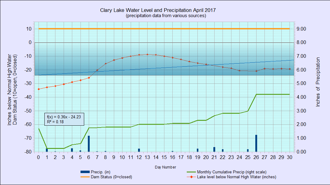
I have archived the April 2017 Water Level Chart (at left). The most notable feature of the April chart is that the lake level rose above the -2 foot mark on April 7th and stayed above that level for the next 24 days, until the end of the month. It also reached -8.76″ below the high water mark when the ice went out on April 13th, which is the highest level I have recorded since I starting making water level measurements back in December 2011. However, the Clary Lake Water Level Order calls for the lake level to be maintained at the normal high water mark from ice out until August 1st and that “at no time during this period shall the lake level be artificially manipulated to be lower than the established normal high water line” so as high as it was, it still fell short of the requirements of the Order. No soup for you, Mr. Kelley.
We received 4.20″ of precipitation during the month of April or about 0.42″ more than the average of 3.78″ bringing us to 10.18″ for the year, or about 2″ below normal. The drought conditions we experienced last summer and fall have been fully relieved with ground water supplies back more or less to normal.
It remains to be seen what the lake level will be like this summer.